


We love it.Originally Posted by 2manymustangs

That clip shows a boat underway coming from under the I5 bridge heading east through the main body towards the Squaw river arm and Pitt arm.
The view behind my boat is looking up the McCloud arm due North. Following the McCloud arm leads to some FANTASTIC scenery, and gets smaller to make a great river run!
Each summer we have met folks up there that plan there major summer Vacation camping up on that section. Last year met up with some great folks from the bay area in a 26' Daytona and a few of their friends that were tent camping up the arm. Everytime we go up there we find new adventure and scenery...I find it hard to believe at times that I am not back in Alaska when I see it.
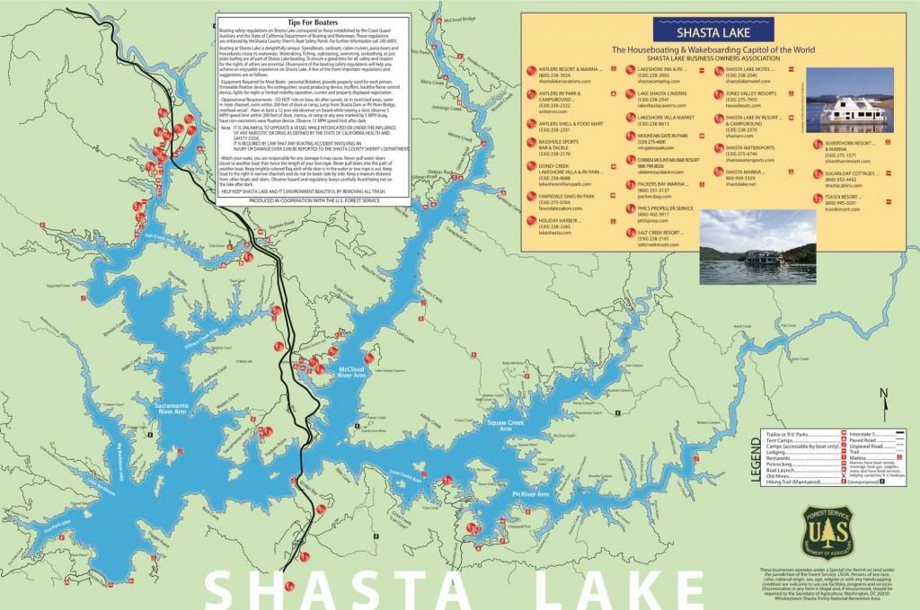
Here is a better detailed map. When the water level is up it is close to 400 miles of shoreline.
Results 1 to 10 of 177
Threaded View
-
03-26-2014, 08:23 AM #21Senior Member

- Join Date
- Dec 2013
- Location
- Redding, CA
- Posts
- 412
Tommy
"So as through a glass, and darkly
The age long strife I see
Where I fought in many guises,
Many names, but always me."
Gen. George S Patton


 Reply With Quote
Bookmarks